
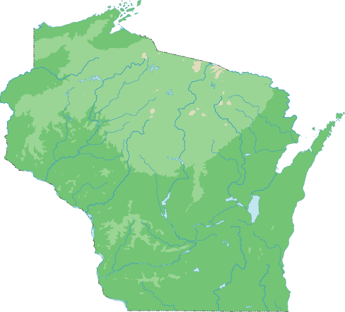
Wisconsin Topographical Map
Static Wisconsin Topo Map
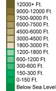
This section features a topographical map of Wisconsin as well as a map legend that specifies elevation ranges and indicates their corresponding map colors.
Map Legend |
 |
|
 |
Wisconsin Topographical Features
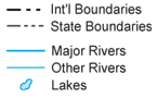
Wisconsin's highest elevation is Timms Hill, which rises to 1,951 feet above sea level. Wisconsin's lowest elevation is 581 feet above sea level, at Lake Michigan. South central Wisconsin is a land of fertile farms, while forested hills cover much of the north. Western Wisconsin features rolling green hills. Major rivers in Wisconsin include the Wisconsin, St. Croix, Rock, Mississippi, and Namekagon.Interactive Wisconsin Topo Map
This section features a topographical map that can be zoomed and panned to show the entire State of Wisconsin or a small portion of the state. To zoom in or out on the map, use the plus (+) button or the minus (-) button, respectively. To pan the map in any direction, simply swipe it or drag it in that direction. At high zoom levels, the contour lines on this Wisconsin map can help outdoorsmen, land developers, and others to plan their routes and activities more efficiently.
Copyright © 2005-2024 State-Maps.org. All rights reserved.
Wisconsin-Map.org is a State Maps reference source.
Wisconsin-Map.org is a State Maps reference source.